
Results for "Midland"
Filters
Showing 265–288 of 510 water locations
Scaldwell Bay
A bay in East Midlands.
Hellidon Well
A spring in West Midlands.
Aztec Adventure Sailing Pool
A lake in West Midlands.
Gordon Grey lock
A river in East Midlands.
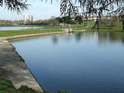
Witton Lakes
Witton Lakes (previously known as Upper Witton Reservoir and Middle Witton Reservoir) are a pair of former drinking water reservoirs between the Perry Common and Erdington areas of Birmingham, England (not in nearby Witton). Two brooks, arising at Kingstanding and Bleak Hill, Erdington, respectively, feed first Witton Lakes, then overspill into Brookvale Park Lake (previously known as Lower Witton Reservoir), before reaching the River Tame, and eventually the Humber and the North Sea. The brooks are natural; the lakes were completed in 1880, to supply drinking water for Birmingham.
The Mires
A spring in West Midlands.
Millfields Pool
A reservoir in West Midlands.
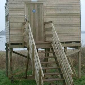
Belvide Reservoir
Belvide Reservoir is a reservoir in South Staffordshire, England. It was built in 1833 to supply the Birmingham and Liverpool Junction Canal, and has been managed as a nature reserve since 1977. It has been used to study the effect of water level changes on bird populations.
Lodge Inlet
A bay in East Midlands.
Middle Pool
A lake in West Midlands.
Hands Well
A spring in West Midlands.
West Towthorpe Hollow Pond
A lake in East Midlands.
The Horse Pool
A lake in West Midlands.

Chasewater
Chasewater is a reservoir located in the parish of Burntwood and the district of Lichfield in Staffordshire, England. Originally known as Norton Pool and Cannock Chase Reservoir, it was created as a canal feeder reservoir in 1797. The reservoir was created to directly supply the Wyrley and Essington Canal and maintain levels in the 160-mile (260 km) Birmingham Canal Network.

Fens Pool
Fens Pools (grid reference SO920886) is a 37.6 hectares (93 acres) biological site of Special Scientific Interest in the West Midlands. The site was notified in 1989. under the Wildlife and Countryside Act 1981 and is currently managed by the Country Trust.
Camp Lane Pits - South Pit
A lake in West Midlands.
Lawn Pool
A lake in West Midlands.
Overseal Reservoir
A reservoir in West Midlands.
Town Well
A spring in West Midlands.
Ladymoor Pool
A lake in West Midlands.
Berks Well
A spring in West Midlands.

Engine House Pool
Earlswood Lakes is the modern name for three man-made reservoirs which were built in the 1820s at Earlswood in Warwickshire, England, to supply water to the Stratford-upon-Avon Canal. They still supply the canal, and also provide leisure facilities, including sailing, fishing, and walking. The northern banks of the lakes form the borough and county boundary with the Metropolitan Borough of Solihull and the West Midlands.
Dipper
A lake in East Midlands.
Sprite
A lake in East Midlands.