
Results for "Wales"
Filters
Showing 577–600 of 917 water locations
The Warren
A beach in Wales.

Joe's Waterfall
A waterfall in Wales.

Jepson's Pond
A reservoir in Wales.

Pwll Uffern
A waterfall in Wales.
Wales Lake
A reservoir in Missouri.

Aber-pwll
A bay in Wales.

Pentwyn Lake
A lake in Wales.

Porth yr Ysgraff
A bay in Wales.
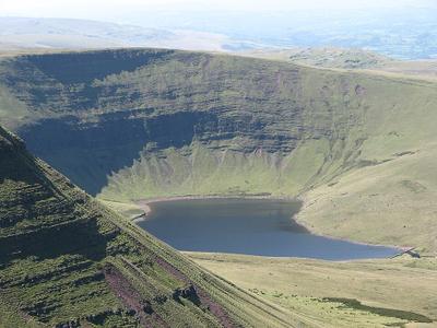
Llyn y Fan Fach
Llyn y Fan Fach (Welsh meaning "little lake of the peak") is a lake of approximately 10 hectares (25 acres) on the northern margin of the Black Mountain in Carmarthenshire, South Wales and lying within the Brecon Beacons National Park. The lake lies at an altitude of approximately 1,660 feet (510 m), immediately to the north of the ridge of the Carmarthen Fans. It is the smaller of two lakes within this mountain massif: the slightly larger Llyn y Fan Fawr is about 2 miles (3.2 km) to the east.

Delta Lakes
A lake in Wales.

Porth yr Aber
A bay in Wales.
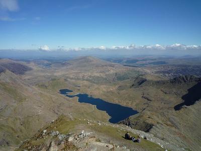
Llyn Llydaw
Llyn Llydaw (Welsh for 'Brittany lake') is a natural lake in Snowdonia National Park on the flanks of Snowdon, Wales' highest mountain. This long thin lake has formed in a cwm about one-third of the way up the mountain. It is one of the most visited lakes in the United Kingdom, in that many thousands of people every year visit Snowdon and many walk past this lake on the Miners' Track.

Llyn Cwm-corsiog
lake in Gwynedd, Wales

Llyn Dwythwch
lake in Gwynedd, Wales
Malltraeth Sands
A beach in Wales.

Kenfig Sands
A beach in Wales.

Porth Neigwl
Porth Neigwl, also known in English as Hell's Mouth, is a broad bay, about 3 miles (5 km) wide, on the south coast of the Llŷn Peninsula in North Wales. The bay faces south-west and lies between the headlands of Mynydd Rhiw to the west and Mynydd Cilan to the east. These craggy headlands have cliffs descending to the sea, and Porth Neigwl is said to be like a broad open mouth in the relief of south Llŷn.
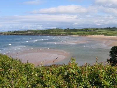
Lligwy Bay
Lligwy Bay (Welsh: Traeth Lligwy) is a bay of the Welsh island of Anglesey. It is on the north east of the island, to the north of the village of Moelfre. It was the site, in October 1859, of the loss of the steam clipper Royal Charter with a loss of life in excess of 450.

Tresilian bay
Tresilian Bay, also Tresillian Bay, is a bay in southeast Wales, west of Llantwit Major's Collugh beach and east of St Donats, on the Bristol Channel. The beach at the bay lies in front of a valley in which the Nant Tresilian flows and empties in the sea. It lies along a stretch of coast and cliff path under protection by the Glamorgan Heritage Coast, characterised by limestone cliffs with many caves and several bays/valleys.
New Quay Beach
A beach in Wales.
Dinas Reservoir
reservoir in Ceredigion, Wales, UK

Nantcol Waterfalls
A waterfall in Wales.
Gogarth Bay
A bay in Wales.
Gogarth Well
A spring in Wales.
Advertisement