
Results for "Wales"
Filters
Showing 193–216 of 917 water locations

Lower Bight
A bay in Wales.

Bae Bach
A bay in Wales.
Nant Lonydd
A spring in Wales.

Poppit Sands
Poppit is a small, dispersed settlement which lies on the southern side of the estuary of the River Teifi, near Cardigan, in northern Pembrokeshire, Wales. It is primarily known for its popular sandy beach, called Poppit Sands (Welsh: Traeth Poppit) which adjoins St Dogmaels beach at its eastern estuary end. The beach offers views across the estuary and bay towards Gwbert and Cardigan Island, and the nearest village is St Dogmaels, 1+1⁄2 miles away.

Nant y Rhigos
A spring in Wales.
Wales Creek Reservoir
A reservoir in Montana.

Traeth Penrhos
A beach in Wales.

Traeth Bach
A beach in Wales.
Castell Nos Reservoir
reservoir near Maerdy

Ffontygari Bay
A bay in Wales.

Slade Bay
A beach in Wales.

Llyn Sarnau
lake in Conwy County Borough, Wales, UK
Wooltack Bay
A bay in Wales.

Banwen Community Fishery
A lake in Wales.
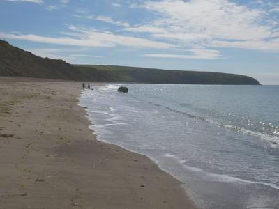
Traeth Aberdaron
A beach in Wales.

Melincourt Waterfall
Melincourt Falls (Welsh: Sgwd Rhyd yr Hesg) is an 80 feet (24 m) high waterfall on Melin Court Brook, a left-bank tributary of the River Neath / Afon Nedd, located 1-mile (1.6 km) south of Resolven in the county borough of Neath Port Talbot, south Wales. It is formed where the brook plunges over a resistant band of 'Lower Pennant Sandstone' in a 13 acres (5.3 ha) nature reserve managed by the Wildlife Trust of South and West Wales. The falls have been drawing visitors for at least two centuries – they are certainly known to have inspired J. M. W. Turner to paint them in 1794.
Pobbles Bay
A bay in Wales.

Porth Cadlan
A beach in Wales.
Ffynnon Rufeinig
A spring in Wales.

Crai Reservoir
Crai Reservoir (also known as Cray Reservoir) is a storage reservoir located in the Brecon Beacons National Park (named after the village of Crai) for the water supply to the city of Swansea in South Wales and was built between 1898 and 1908 by Swansea Corporation. The reservoir now supplies water to the towns in the valley of the River Tawe and north Swansea. The reservoir is one of several established in what is now the Brecon Beacons National Park, an area of Old Red Sandstone peaks with relatively high rainfall.

Pwll Y Wrach
Pwll y wrach or Pwll-y-wrach (Welsh for "pool of the witch") is a feature on the River Ennig near Talgarth in south Powys, Wales. The river plunges in two separate streams over a lip of hard rock (Bishop's Frome Limestone, formerly known as Psammosteus Limestone) into a pool scoured in the softer mudstones of the underlying Raglan Mudstone formation. The feature occurs within Cwm Pwll-y-wrach, a deep wooded valley that is a Site of Special Scientific Interest and a nature reserve managed by the Brecknock Wildlife Trust.
Hen Borth
A bay in Wales.

Llyn Coch
lake in Gwynedd, Wales

Llyn y Dywarchen
lake in Migneint, Gwynedd, Wales
Advertisement