
Live · updated daily from USGS
Swimmable water near you
2,135 USGS sensors are reporting a live water temperature right now, the newest reading from August 21, 2026 (15 hrs ago).
- Cold · below 60°F · 375
- Cool · 60–69°F · 594
- Comfortable · 70–86°F · 938
- Warm · above 86°F · 228
- You
A map of the United States with one coloured dot per USGS sensor reporting a live water temperature. The readings are listed below.
Nearest live readings
The closest USGS sensors currently reporting a water temperature, nearest first.
- ERIE(BARGE)CANAL(W OF GENESEE R)AT ROCHESTER NYUSGS gauge · New York · 4 ft³/s75°F9.6 mi15 hrs ago
- GENESEE RIVER AT FORD STREET BRIDGE, ROCHESTER NYUSGS gauge · New York · 732 ft³/s73°F11 mi15 hrs ago
- ALLEN CREEK NEAR ROCHESTER NYUSGS gauge · New York · 7 ft³/s62°F14 mi15 hrs ago
- IRONDEQUOIT CR ABOVE BLOSSOM RD NEAR ROCHESTER NYUSGS gauge · New York · 64 ft³/s64°F15 mi15 hrs ago
- NORTHRUP CREEK AT NORTH GREECE NYUSGS gauge · New York · 2 ft³/s64°F18 mi15 hrs ago
- SANDY CREEK AT NORTH HAMLIN NYUSGS gauge · New York · 62 ft³/s67°F25 mi16 hrs ago
- OAK ORCHARD CREEK AT THE BRIDGES NYUSGS gauge · New York · 457 ft³/s76°F34 mi15 hrs ago
- OAK ORCHARD CREEK NEAR SHELBY NYUSGS gauge · New York · 21 ft³/s68°F35 mi15 hrs ago
Nearest swimmable spots
Rated, photographed water destinations within 25 miles — pair one with the nearest sensor reading above before you go.
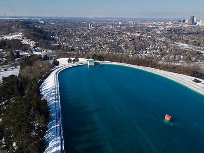 4.7(92)
Cobbs Hill Reservoir
This concrete reservoir on a hill features a fountain, a granite Greek Revival gatehouse & more.
12 mi from your location
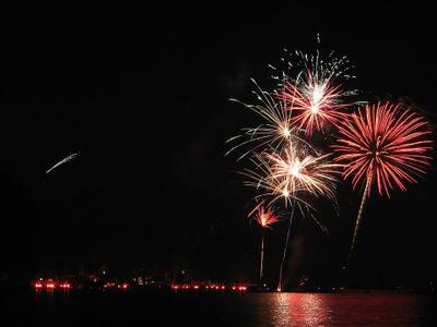 4.8(106)
Conesus Lake
Water sports, fishing, kayaking & a lively 4th of July celebration draw locals to this popular lake.
15 mi from your location
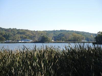 4.4(41)
Irondequoit Bay
Narrow bay connected to Lake Ontario, with surrounding parks, fishing access & boat-launch sites.
17 mi from your location
About this map
Every pin is a live reading from a USGS real-time monitoring station, captured in a daily snapshot. Colours follow the site’s cold-water-safety thresholds and describe the water at that one sensor — usually a river or stream gauge, not a swim beach — so treat them as a guide to what the water is doing nearby, not a verdict on a specific spot. Readings are provisional and can be revised by the USGS. Your location only sorts this page: the coordinates appear in the address bar (rounded to about a mile) and are not saved to an account or our database.
Conditions are for general information only and can change quickly. Always judge the water in person and follow posted advisories and local guidance before swimming or paddling.